Step By Step
Published June 2022
By Susan Dragoo | 28 min read
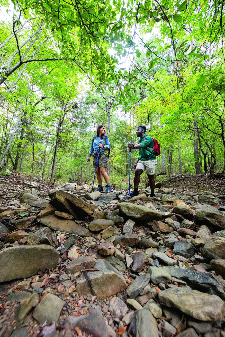
According to the Environmental Protection Agency, Oklahoma is home to more than a dozen distinct ecoregions, giving it some of the most varied terrain in the nation. And there’s no better way to fully experience this variety than on foot, whether scrambling over worn granite peaks peppered with scrub oak and prickly pear or strolling along a clear mountain stream beneath pines and Caddo maples. Here are some expert tips and six of the Sooner State’s premier trail systems to get you started.
Safety Dance
-
Though they are small, ticks still can cause a myriad of health problems and are common in the state in warmer months. The Oklahoma Center for Poison and Drug Information recommends wearing long-sleeved shirts, long pants tucked into socks, closed-toe shoes, and light-colored clothing to help spot ticks more easily. Be sure to do regular checks both during and after the hike; use insect repellent on skin and clothing; and contact a physician immediately if you become sick after a recent tick bite or visit to a tick-heavy area.
-
According to the Sierra Club, the most common mistakes that lead to hiking hazards include underestimating the trail and overestimating your physical capability. Research a trail’s length, elevation, and difficulty rating before striking out, and be realistic about your body’s readiness for those conditions.
-
In Oklahoma, hiking in the heat can be especially daunting. Summer hiking is best done early in the morning with a sun hat and plenty of water.
-
Hike with a partner or tell someone where you are going and when you plan to return. Experienced hikers often carry a personal locator beacon or satellite communicator to help rescuers locate them in an emergency.
-
Failure to prepare for changes in weather or emergencies that could delay your return is another common error. On a mild day, heading out for a short hike with only a candy bar and an iPhone may be fine if all goes well. But if you get lost or injure an ankle and have to be out overnight, misery may ensue.
Gear Up
Make sure you’re properly outfitted with these tips from John James, owner of Native Summit adventure outfitters in Edmond.
Backpack Choose an internal frame pack with an eighteen-to-thirty-five-liter capacity for day hikes. You’ll need thirty-five liters or more for overnight hikes and more for multiple-day outings. Take your time and pick the right pack for your body. Comfort is crucial, so seek the help of an experienced pack fitter.
Water Treatment There are many ways to disinfect water, but only buy a water filter from a reputable brand. If you’ll need to filter water on your hike, consult a map to get an idea where you can access water along the way.
Hiking boots and shoes Full or mid-height boots with a Vibram sole are the trail standard. Choose wisely here. For day hikes, low-top hiking shoes or trail runners can suffice. Either way, fit and the right amount of protection are key. Spend the most time picking your footwear and backpack.
Headlamp A headlamp gives you much-needed light while letting you keep both hands free for other tasks. Be sure to pick one with at least a hundred lumens and multiple modes of operation for maximum versatility.
First Aid Kit Make sure yours includes bandages, moleskin, duct tape, and some basic medications.
Duct tape Duct tape is a go-to tool for dealing with hotspots and blisters—especially on the feet—and field repairs of tents and backpacks. Make a small roll about the size of a tube of lip balm, and keep it in your pack. Better yet, wrap some around your lip balm or lighter to save some space.
Firestarter Get familiar with basic fire-starting techniques. Have backup methods like a lighter, ferro rod, matches, and several firestarters.
Map and compass or GPS Have a way, however basic, to navigate. Practice using it before heading out.
A multitool This has many uses including cutting fruit, opening packaged food, removing thorns and splinters, and protection against wild animals.
Food A gallon of water weighs more than eight pounds, so dehydrated food is common in hiking. While you can aim to save weight, don’t cut energy. You will burn more calories than normal and likely will have a bigger appetite. Plan what you are going to eat and when to be sure you have enough to last your entire outing.
Water The rule of thumb is to drink two liters per person per day during the day. If you are going to use water to cook, you’ll need more, so a cooking stove such as a JetBoil is an essential tool.
Overnight Sensation
A quick day hike is one thing, but if you’re planning a longer trek down the Ouachita Trail or backpacking into Charon’s Garden Wilderness for nights of solitude with the stars, there are additional considerations for multi-day hikes.
Keep it Light You’re carrying everything you need for food, shelter, water, and other essentials on your back, so be mindful of the weight. Beginning hikers may underestimate the challenge of carrying thirty-plus pounds over several miles, so it’s wise to keep pack weight down and train for a backpacking trip by carrying the expected amount of weight on practice hikes.
Stay Dry Many backpackers carry a tent, but some prefer a tarp, bivouac sack, or hammock. Any of these can be good solutions depending on the weather and other factors, but the key is adequate protection from the elements. If you’re using a new shelter, be sure to test it before you go. Even if it’s not new, setting up your tent before a backpacking trip is a wise move, because tent materials can deteriorate with time, improper care, or unprotected storage, allowing leaks and sometimes causing seams to fail.
Sleep Cozy Who says sleeping on the ground can’t be comfy? Don’t cut corners here. Go to a proper outfitter to get expert advice on sleeping bag selection, and don’t forget a good sleeping pad.
Eat Well There’s a wide array of food—even vegan options—intended for backpacking, made lightweight and convenient via dehydration. Gotta have your cup o’ joe? There are several good instant varieties, but you can also carry a small coffee press if you think it’s worth the weight.
Pick the Right Spot Camp close to a water source for cooking, cleaning up, and filtering for the next day’s supply, but select a site at least two hundred feet away from water to avoid contaminating streams. Camping on higher ground is best, especially along a river or in canyons, as low spots tend to collect water. To lessen your impact, camp on a previously established site. Many trails have them.
The Where of it All
Oklahoma’s über-diverse terrain offers hikes of all difficulty levels and in all types of scenery for weekend warriors and veteran outdoorspeople alike. These six spots are just a few of the amazing nature walks the state has to offer.
The Ouachita Trail
The Ouachita National Forest is the oldest national forest in the southern United States, and more than 350,000 of its 1.7 million acres extend into southeast Oklahoma. It encompasses most of the Ouachita Mountains, a rugged landscape dominated by hardwoods and pines. Hiking trails, both short and long, are everywhere. The longest and most epic is the Ouachita National Recreation Trail, at 223 miles, with 46.3 of those in Oklahoma and the remainder in Arkansas. The trail begins near Talihina and ranges in elevation from 600 to 2,600 feet, meaning steep climbs and challenging hiking.
Camping is allowed anywhere along the Oklahoma section, but finding a level spot on this segment can be difficult, so trail shelters come in handy. These three-sided wooden structures, each with a sleeping platform, picnic table, and fire ring, provide a respite for backpackers spending a night or two on the trail or traversing the entire span in one trip. They are located about every ten miles, beginning in the west with the Rock Garden shelter at mile 9.4. Friends of the Ouachita Trail, a nonprofit volunteer group that maintains the trail, constructs all of the shelters on the Oklahoma side.
Much of the Oklahoma section of the Ouachita Trail parallels the Talimena Scenic Drive, and the first twenty-four miles have a reputation for being the toughest. It’s narrow, rocky and steep, and water sources are few. Views abound along the way, and Holson Valley Vista is one of the best; fortunately, there’s a shelter there, too. High up on these ridges, the trail is magical, snaking through tightly clustered oaks and becoming soft underfoot thanks to mounds of fluorescent green moss coating the path. Once the trail reaches Winding Stair Campground, it descends to Big Cedar Creek and the Kiamichi River, providing some of the route’s most beautiful scenery. Stream crossings and spectacular rock formations become more frequent and can be easy or challenging depending on rainfall, but they are always scenic.
Hikers who want to bail out at the Arkansas line can leave the trail at the State Line Parking Area on the Talimena Scenic Drive, but many continue to the trail’s end near Little Rock or take advantage of the numerous access points in between.
Ouachita National Forest
fs.usda.gov/main/ouachita
Friends of the Ouachita Trail
friendsoftheouachita.org
Talimena State Park
50884 U.S. Highway 271 in Talihina
(918) 567-2052
TravelOK.com/talimena
The more than 200-mile Ouachita National Recreation Trail begins at Talimena State Park and extends to Perryville, Arkansas. Photo by Lori Duckworth
Chickasaw National Recreation Area
For a walk on the mild side, the Chickasaw National Recreation Area in Sulphur offers a hiking experience both picturesque and historic. On the edge of the Arbuckle Mountains, it’s pleasant here any time of year, with shady paths winding through oak and sycamore forest and along clear streams. The freshwater and mineral springs have been protected by the federal government since 1902.
One of the easiest and loveliest trails is Antelope and Buffalo Springs, a 1.2-mile round trip from the Travertine Nature Center. The flat, wide path meanders along the creek to Buffalo Springs, which bubbles up into a circular stone enclosure. Beyond the spring, when the leaves are off the trees, bridges from an abandoned park road are easily visible and tempting to examine. Returning to the trailhead, the route takes in Antelope Springs.
The Travertine Nature Center also is a starting point for the Travertine Creek Trail, which follows the stream 1.5 miles to Pavilion Springs, taking in several waterfalls in the process. It is wide and well-kept, with a few more ups and downs. Multiple spur trails go down to the creek for a closer look or a dip.
From Pavilion Springs, a tunnel crosses under U.S. Highway 177 to the 1.9-mile Bison Pasture Loop/Bromide Hill Trail. After a long, flat section, this one gets steep as it climbs to the Bromide Hill Overlook, affording a view of the town of Sulphur to the north. From the rocky promontory, the path descends toward the Bison Viewpoint, circling a small lake and emerging on the highway at a viewing station for the park’s bison herd.
While these trails are in the NRA’s central core, there also is an ADA-accessible trail at Veterans Lake, located to the southwest. The 2.8-mile path is paved all the way around, with picnic areas on the north side and multiple benches for those wanting a break along the way. Near Veterans Lake is the northern trailhead for the Rock Creek Multi-Use Trails, providing more than four miles of unpaved hiking.
Although there is no dispersed camping in the park, and thus no backpacking per se, campgrounds abound, making it easy to tent it overnight and day hike. Other special places in the Chickasaw NRA are the beautiful Lincoln Bridge, built in 1909, and the Little Niagara swimming hole, located near the Travertine Nature Center.
Chickasaw National Recreation Area
901 West First Street in Sulphur
(580) 622-7234
nps.gov/chic
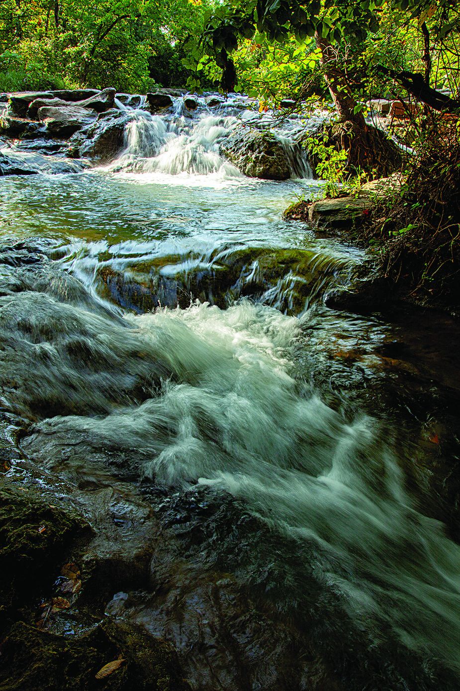
Panther Falls is one of the waterfalls hikers at the Chickasha National Recreation Area can visit. Photo by Iris Greenwell
Wichita Mountains Wildlife Refuge
In the southwest corner of Oklahoma lies a granite wonderland—the Wichita Mountains, a dramatic range that provides a hiking experience of a completely different sort. The peaks are worn to bald knobs and massive boulders, and hardpack hiking trails weave through, over, and around them. The principal public hiking area is in the 59,020-acre Wichita Mountains Wildlife Refuge, which protects bison, Texas longhorn cattle, elk, and prairie dogs. The level of challenge varies among the trails in the refuge, so both beginners and experts will find something satisfying. Ascending to the summit of Elk Mountain offers a reasonably simple one-mile climb. Here, aside from the view, there are rock rooms and caves to be explored. In fact, the Wichitas are a delightful place to explore off trail, as long as you have a map and a compass, as one boulder looks an awful lot like another.
The Dog Run Hollow Trail System offers a mostly flat set of loop hikes, following West Cache Creek and skirting both Lost Lake and French Lake. Along the creek are several small dams and one weird concrete fish ladder, built to allow fish to swim up West Cache Creek and over the French Lake dam. It reportedly never worked, but it is a fascinating oddity. Nearby is the path to Forty Foot Hole, a picturesque natural depression appreciated by hikers who brave the summer heat.
For the more intrepid hiker, the Narrows Trail follows West Cache Creek through a tight, high-walled canyon, extending about a quarter of a mile. As the trail moves from one side of the stream to the other, stream crossings are frequent, but as with the Ouachita Trail, whether those crossings are wet or dry depends on recent rainfall. After the trail peters out, it’s possible to continue along the creek to the Pennington Mine, a remnant of the gold rush days of the early 1900s.
The Wichita Mountains’ premier hiking area, and the only section of the refuge open to backpacking and dispersed camping, is Charon’s Garden Wilderness Area. The trails in this rugged, 5,723-acre wilderness area are more like suggestions. Though a map at the trailhead shows one distinct north-to-south path, there are, sometimes disconcertingly, multiple options. Flanked by the pink granite mountains that look like gargantuan mounds of oversized cobblestones and with such memorably named formations as Crab Eyes and Sunset Peak, it’s more a web of paths and an opportunity to choose your own adventure than a trail. Set your cap for Crab Eyes and walk in that direction, or navigate for Post Oak Falls and experience Valley of the Boulders and the rock rooms along the way.
Those planning to stay overnight in Charon’s Garden will need a backcountry permit, available for a nominal fee at recreation.gov.
Wichita Mountains Wildlife Refuge Visitor Center
32 Refuge Headquarters Road in Indiahoma
fws.gov/refuge/wichita_mountains
Friends of the Wichitas
friendsofthewichitas.org
.jpg)
Along with hiking, the Wichita Mountains Wildlife Refuge is a popular rock climbing destination. Photo by Kim Baker/Oklahoma Tourism
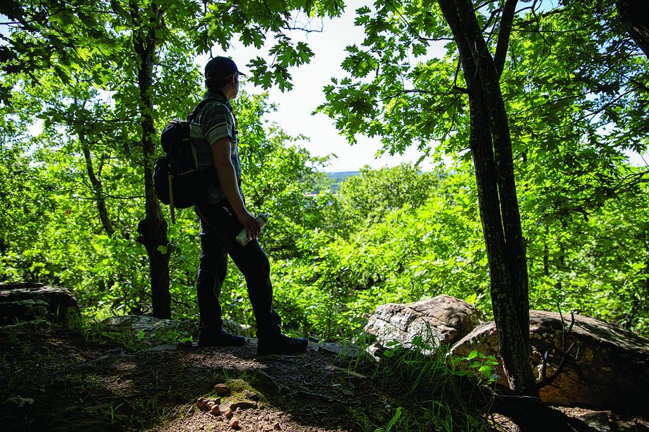
Keystone Ancient Forest
Keystone Ancient Forest provides hikers the opportunity to experience the Cross Timbers ecosystem in its ancient form with more than 1,200 acres of protected historic and endangered woodlands.
The well-marked trails at Keystone range from the paved Childers Trail, a 0.6-mile ADA-accessible path, to the difficult Wilson Trail, a one-mile journey into a rocky playground for the more adventurous hiker. It is delightful or grueling—depending on your perspective—and sturdy shoes or boots and hiking poles are highly recommended. Narrow and very rocky, the Wilson Trail descends below the bluff line, through large rock formations, and across seasonal streams.
The centerpiece of the trail system is the Frank Trail, about 2.8 miles of easy-to-moderate unpaved trail, leading to a view of the Arkansas River basin. Attempting to identify the namesake ancient trees along the trail is an exercise requiring some imagination.
“It is very hard to age a tree, especially the post oak and blackjack oaks that dominate Keystone Ancient Forest,” says Katie Gillies, director of conservation for the Nature Conservancy, which collaborates with the City of Sand Springs to manage the preserve. “Size is no indication of age, but if it’s large, with sprawling branches and a thick base, it may be one of the ancient ones.”
The 4.1-mile Less Traveled Trail creates some additional walking miles. Much of it is flat, but some rocky ups and downs enhance the challenge and provide a good workout.
Keystone Ancient Forest
160 Ancient Forest Drive in Sand Springs
(918) 246-2661
sandspringsok.org
When Keystone Ancient Forest began opening to the public Thursday through Sunday, hundreds of people showed up to hike these picturesque trails. Photo by Lori Duckworth
Black Mesa State Park & Nature Preserve
Traveling northwest toward the Oklahoma Panhandle, the elevation rises as the vegetation diminishes. Eventually, flat farmland yields to buttes and mesas, where cholla cactus and prickly pear dot the landscape. In the farthest corner, abutting the New Mexico and Colorado borders, is the highest point in Oklahoma: Black Mesa.
The mesa itself is huge, spreading across the borders of three states. Its name comes from the layer of black lava rock that coated the mesa about thirty million years ago, the product of a Colorado volcano named Piney Mountain. It has provided a wealth of paleontological riches, including more than eighteen tons of dinosaur bones that have been quarried here. Along Carrizo Creek, just north of the mesa, dinosaur footprints preserved in a creek bed are a popular attraction.
The trail to the 4,973-foot summit begins with a relatively flat trek around the base of the mesa on a wide, open trail. After two miles, the trail begins to ascend a steep, rocky, and rutted old road, but it flattens out on top, and the remainder of the 4.2-mile trip to the summit is a breeze. Though sparsely marked, the trail is easy to follow, and once hikers attain the top of the mesa, an obelisk becomes obvious in the distance. That marker signifies the state’s highest point. A cache at the base contains a register so hikers can document their visit.
But don’t stop at the marker. There are two spur trails to the mesa’s edge, one to the south and one to the west, and the views are spectacular. But be conscious of both the high winds atop the mesa and the rattlesnakes who like to bask on the tabletop’s rocky edges.
The mesa itself is protected as part of the 1,600-acre Black Mesa Nature Preserve. Camping is not allowed within the preserve but is available at Black Mesa State Park about fifteen miles away. With some of the country’s darkest nighttime skies on publicly accessible land, the area also is a popular destination for astronomy enthusiasts.
Black Mesa State Park & Nature Preserve
County Road 325 in Kenton
(580) 426-2222
TravelOK.com/state-parks/black-mesa-state-park-nature-preserve
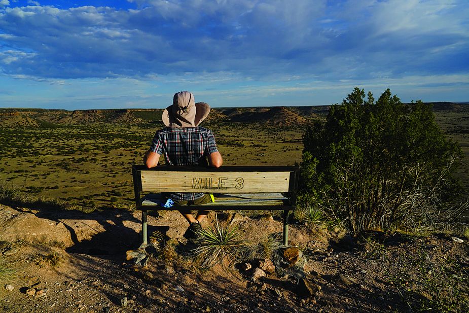
The expansive views at Black Mesa make the 8.4-mile round-trip trek to the top worth the effort. Photo by Laci Schwoegler/Retrospec Films
Robbers Cave State Park
While the trails at Robbers Cave State Park can feel remote, that’s a benefit for multi-day hikers, as the park’s footpaths can be linked up for backpacking, with primitive campsites available dotting the way.
The namesake cave is a must-see. Even better is exploring the rock formations surrounding it, which create narrow passageways reminiscent of slot canyons. The Rough Canyon Trail, with its irresistible-to-hikers name, begins at the cave parking lot. The first mile is indeed rough and rocky with lots of uphill, running along a stream briefly before turning into a dense pine forest. After more uphill, it intersects with the Cattail Pond Loop, which incorporates a stream crossing and circles the body of water from which it gets its name, passing a primitive campground before it turns toward Lost Lake and another backcountry campground.
The primary starting point for the Mountain Trail is at the Deep Ford Campground. This is the park’s signature trail, navigating the shores of Lakes Carlton and Wayne Wallace before connecting with the Rough Canyon Trail. Wayfinding can be difficult, however. As the trail climbs above Lake Carlton, it is easy to confuse the spur to the bluffs with the main trail and veer off course. The view here is breathtaking, but remember the main trail goes above the bluffs, not below.
A 6.3-mile multi-use trail connects with the Mountain and Rough Canyon trails, creating an overnight loop of 11.5 miles, making Robbers Cave a must-trek destination for overnighters and day hikers alike.
Robbers Cave State Park
4628 Northwest 1027th Street in Wilburton
(918) 465-2562
TravelOK.com/state-parks/robbers-cave-state-park
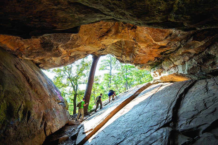
A short but vigorous jaunt through boulders and hardwood forest takes visitors to Robbers Cave State Park’s namesake attraction. Photo by Lori Duckworth